Tuesday, March 24, 2020

"I can hear the birds again..."

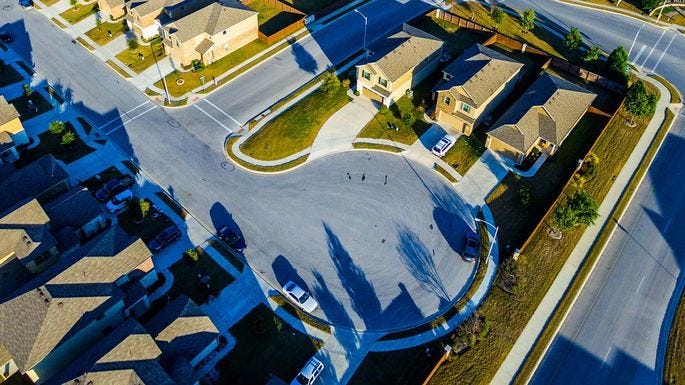
Photo by Hédi Benyounes on Unsplash

The impact of the US virus shutdown on everything has been stunning. On the phone with the pediatrician (yes, we're one down), she remarked that she never heard the birds before because of all the traffic noise - and she's pretty far back from the road.

We don't have issues with pollution, but I'm sure many cities have seen dramatic changes. No traffic counts are valid after March 13th because the volumes are nearly non-existent. Gas prices are as low as they've been since 2003, but no one notices.

I sat out on our front porch this morning and saw at least 7 different sets of neighbors, some chatting on phones, some walking dogs, some just playing with their kids. Most of them I knew. Some I met for the first time.

My son is out on the front driveway with his buddy just hanging out 6 feet apart because I took away his keys. He's been getting stir-crazy and trying to figure out how to hold his tutoring sessions online.

Life is more digitally connected, but I see people being far more intentional about physical connection too. The choice to stay home takes on new ethical ramifications. We miss what we can't have. The wake-up call is good.

Dads are spending time with their kids - Heck, moms are spending time with their kids too (guilty). Dinner is at home together instead of on the run - or at least mostly together - Katie is double quarantined so I had breakfast with her in her bed. She's pretty happy about nearly unlimited Disney+ time, but misses her teachers and friends terribly. We're beginning to think about what it looks like for a cognitively disabled child to be employed digitally. Our church small group is going to meet via Zoom at our normal Thursday night time. Another group is meeting outside at a coffee shop and planning how to deliver supplies to those who are quarantined at home. Small towns mean close neighbors and dense support networks. Big towns are working on creating the same connections.

We have been blessed. We continue to work from home and have little disruption to our lives or futures. Many are rightfully scared about what the future holds both for life and making a living. Many who have been content just making it may realize that they need to catch up digitally and find new careers. Grocery store workers are esteemed as highly as police and firefighters. Nurses and doctors are heroes again. We all contribute to the whole and none of us are expendable.

Life will go back to normal, but I'm hoping it won't be the same normal. I could be content with some of these changes being permanent.

#Covid19 #NewNormal #grateful

Tuesday, March 17, 2020

How will CoVID-19 change communities?

Winter Garden, FL  Photo: PJ Tice

I just got back from my small town polling place. There were lots of discussions about the virus, but no fear. The elderly folks from the Lion’s Club that man our polling place were just as friendly and cuddly as ever — it’s a hugging town. Social distancing was more of a joke than a panic. As a small urban space west of Orlando, where there are already two confirmed deaths, you would think that they would be more concerned, but they’re not.

Downtown, people are far more reactive. Our mega-church has cancelled in-person meetings for the rest of the month, resorting to Facebook and YouTube. Many of us created informal watch-parties with our small groups to get together around breakfast last Sunday. We’re planning to do it again next week.

This is where small-town America has the edge over Urban America. In our small town, we will see a few hundred people a day, who see the same few hundred people. As I chatted with one of the candidates at the polls, her mechanic husband greeted nearly every person that passed us by name. The risk is greater at WalMart where several thousand people move through the space on any given day, but again, it’s the same few thousand people. It’s two orders of magnitude less than moving through a transit station that may have seen hundreds of thousands of people in a day from around the world or a downtown that serves 8 million people.

I read a trend article a few weeks ago that started with “people will continue to move to cities” and then followed with 9 other items that made urban life unnecessary like telecommuting, deliveries, and digital transitions. Living in a large city is hard. It’s emotionally draining. It’s expensive. Crime rates are higher. More to the point, social support is much less and the potential for disease transmission is exponentially higher than lower density areas.

I do think small towns will pick up more more urban characteristics. Small urban is very different from typical suburban development. Mile-long cul-de-sac projects and gated subdivisions are just as isolating as the most dense urban areas. As people become more digitally connected, the value of a unique place and strong human connections becomes even more critical. Even in the suburbs, where driving is king, congestion is a pain. Mixing land use at a local scale means your trip can be only a mile instead of five. Kick in a scooter or bike and that one mile trip doesn’t need a car at all. That means that small communities with good walking and biking infrastructure and a nice land use mix provide all the advantages of an urban area with much less risk.

There will always be people who want to live with the excitement of a large urban area. There’s a great energy being surrounded by so many different people. The question may become, is it worth it and can we do it differently? The current pandemic isn’t a huge risk to the majority of the population. We are taking precautions to care for those who are at risk. The 1918 flu hit the youngest and strongest. Small urban places will remain fairly isolatable, while large urban centers will remain risky. Transit systems can be sanitized. but the sheer number of strangers you encounter on a daily basis amplifies the risk in a way that is much harder to counteract.

Americans have always wanted to have their cake and eat it too. Small urban spaces may provide just what we needed.

Friday, February 21, 2020

Engineers Week 2020: Moving Forward

Photo by JOHN TOWNER on Unsplash
I became an engineer because I had already made it past the hazing (Differential Equations). I remain a transportation engineer because for the first time in my life I see hope.
Traffic seems to be a universal complaint that guarantees job security for all of us. Roman soldiers were probably complaining about the rabble in front of their chariots thousands of years ago and it’s difficult to imagine a time when congestion of some kind will not be an issue, even if it’s digital. (Hey honey, why’s the internet so slow tonight? — Everyone’s watching the Superbowl. Come look at this cool commercial!).

The obvious solution was to move people out of their cars. Since I fell in love with transportation policy 25 years ago, the driving thrust has been mode shift: Can we get people into transit? What about walking or biking? One summer in Maine, I biked 5 miles in and out to work every day. Old Town is lovely in the summer and I didn’t have a car. I whined at first, but by the end of the summer I looked great and I felt even better. Back in Florida, I tried getting the same exercise, but a stationary bike is not the same. Biking from my apartment was (and still would be) a dance with death. Mode shift? Great idea, but probably wishful thinking.

I’ve seen painted buses, HOV lanes, slugging, critical mass, complete streets mandates, and literal gas station bans. Nope, nope, nope, nope, nope, and you’ve got to be kidding. None of these could compete with a baby in a carrier, a squirrelly ten year old boy (let’s call him Squirrelly Stevie), or the security of my safety accredited SUV parked right in front of the store’s door. I remember wishing that my post office had a drive through window (I still do).

So what has changed? Why the hope now?

I gave up on shifting the work trip about a decade ago. I worked from home most of the time anyway, and people work where they work. People choose where they live with their workplace in mind, but their choice is driven by the other 60% of their lives and trips. So what about that other 60%? Drop the school size and it will be close to home. Drop the store scale and it can be close to home (thank you, Amazon). Scatter parks everywhere and soccer is nearby. Take-out can be down the street. Distribute the mega-churches into local campuses. Even freight can be neighborhood scale at Christmas. Incorporate a complete streets analysis into every resurfacing project and bike lanes appear overnight — they’re not suitable for Squirrelly Stevie, but it’s a start. Incomplete networks won’t get used, but getting to a complete network is only a matter of time.

Then I saw an e-scooter. On its own (say in the 1990’s when Razor came out with the first kick scooter) it’s not that earth-shaking. By the time I saw my first e-scooter, I had spent nearly a decade with decreased mobility. Time, autoimmune illness, and a sedentary lifestyle had not been kind to my body. The 1/4 mile walk to my office was a struggle, but a scooter could make a huge difference, especially if I didn’t need to carry it inside with me. I liked biking before, but how was I going to store it or fit it in my car? It was a pain to get my leg up over the seat after all those years. Ugh. A scooter was lightweight, portable, and the shared scooters could be readily available when and where I needed them without getting in the way of the rest of my life. Babies could still be a problem for some people, but Squirrelly Stevie was better at it than I was. Suburbanites were beginning to flock to golf carts in the better designed areas, so a transition to a single-person conveyance was not as far-fetched as it had been. Coupled with all the other changes that have been happening, I was beginning to see that mode shift could really happen, for the first time in my life. Scooters could be the gateway drug that suburban people need to transition to a different lifestyle.

Unfortunately, we can’t solve traffic congestion with the same thinking that caused it. Many place the blame on suburban design patterns, but the first suburbs were still very walkable/bikable community clusters. We compounded the suburban spatial scatter with roadway designs that gave place to the car alone. Since John Forester wrote Effective Cycling in 1976, bike lane design has been geared toward serving cyclists that act, move, and think as motorists. In essence, we have placed the safety burden on the talent, training, and care of the cyclist and have paid a dear price for it: 857 bicycle fatalities in 2018 alone. It’s no wonder that mode shift has been a pipe dream for all but a daring few. Is it any surprise that where only cars exist, single use zones can span miles? In contrast, several auto-dominated European countries redesigned their systems so that kids could safely bike. To be sure, their land use was already pretty mixed in many areas, but any new development that ensued maintained the land use mix at a bikeable scale.

Pete Yauch chuckled at me two weeks ago for being a “plangineer” and giving up hope on operations. He’s right. I have. Operational refinements including signal systems, CAV’s, and the like can give me 20% increased capacity on a good day. I need 200% or more. Improved operations and connected vehicles that are aware of users around them will help with incidents, but they can’t fix the congestion. We need low speed mode systems that can serve squirrelly 10 year olds like Stevie across the entire community and we need to take land back from parking (gulp). The laws of physics have been a great ally in designing high speed roads, but they are no help in controlling the behavior of a driver in an urban setting. Urban designs in mixed mode areas need psychological design criteria that we are only beginning to understand.

Transportation engineers are a rare breed. We use science, human behavior, and politics to manage the movement of life around us. We will always need arterials and will likely always need cars to some degree, but the focus on only one mode has been problematic for years. Our bodes rely heavily on blood flow for survival, but also have internal transportation systems that work at smaller scales in the body to get what was in the blood into the brain and other tissues. A body with great blood circulation will die without spinal fluid and lymph systems to transport what the blood can’t. We’ve spent my entire lifetime creating the most dynamic, resilient roadway system the world has ever seen. It’s time to work on recreating and connecting those smaller scale transport systems in a more efficient, life-giving way.

Monday, February 17, 2020

Why urban designers need to study suburbs

Image by Bernardo Ferreria from Pixabay
Cities are sexy. They’re all adventure and possibilities. Risking it all for the chance to hit it big. They have a daring, “If I can make it there, I’ll make it anywhere!” vibe. They are the siren in stilettos or the beefcake on the cover of the raunchy novel — they get your heart going, but they’re not the one you settle down with and marry.
Is it any surprise that the statistics show Millennials moving away from their hipster city digs toward suburbs as they reach their 30’s and have kids? Turns out that the “right one” is not only safe, they’re a cheap date too — housing prices in the suburbs can be 1/3 of the cost of their boujee counterparts. Still, it’s not just the price tag that drives the migration.
It’s panic.
The panic of watching the toddler who has captured your heart dart out into a busy street. It’s the panic of trying to get somewhere safely with a little one in tow. It’s images of Bruce Wayne and his parents in that dark alley, pearls strewn across the pavement. Cities are not safe. That’s all well and good when all you have to look out for is yourself. It’s unacceptable when you are watching out for people you can’t bear to lose. A thousand discomforts can be managed. A single real danger is a deal-breaker. Maybe that explains why my pediatrician swore that “nesting” for dads means buying a new house. Even Iron-Man chooses a cabin in the woods to raise a daughter instead of a high-rise in the city.
The good news for urban designers is two-fold. Migrants to suburbia still want urban connectivity and features. They care about the planet, they just aren’t willing to endanger their loved ones — and they shouldn’t. Multi-generational sustainability is useless if your kids can’t survive their childhood. Second, you can have it both ways if you’re careful. Urban hasn’t always meant big cities with extensive transit systems. Most of the early suburbs would have been considered very urban by today’s standards — walkable, bikeable, and close to everything but the family’s employment. With digital work connectivity, distance to work may become less important anyway. Small scale land use mix and local scale retail/services are key to surviving the retail apocalypse as well as making active transportation feasible.
In the meantime, urban designers could take a lesson or three from observing suburban settings with an eye for what they have done right — the features that make them safe and convenient for the most vulnerable users in the society. It’s nice to live on a cul-de-sac or loop street. It’s even nicer when that dead-end street becomes a live-end street because it has pathways connecting through the dead-end.

https://www.realtor.com/advice/buy/why-do-we-have-cul-de-sacs/

Buffer the connections with landscaping, fences, and lighting. Make sure bikes and people can get wherever they want but cars can’t. The resolution of the network for each mode needs to fit the scale of the mode: connections at 1/8 mile or less for ped/bike, 1/4 mile for scooters, e-bikes, or golf-carts; 1/2 mile for cars. Drive-throughs are not the bane of our existence — for a mom with a sleeping baby, they’re a God-send. Let’s figure out how to do both. Those babies don’t stay little forever.
I am fascinated by the transformation the Netherlands made from car-centric patterns to bike and walk modes that are safe for children as young as three or four. The choice was intentional. Rather than trying to fit bikes into a car-oriented culture, training bikers to think and act like a car, they chose children as their design priority. When children can bike, everyone can bike — and they do. The transformation was driven by moms that were horrified at children being killed in the streets. We now have an entirely new generation of millennial moms that we have trained to love urban environments, including walking and biking as a normal part of life. When they figure out that it’s a lot harder to keep the weight off when they’re driving everywhere, they’re going to want to see change, but not without serious safety precautions.
Rather than suburban, is it possible to create small-urban? Why not?
What strategies can you think of that can bridge the gap from suburban to small-urban?

Tuesday, September 17, 2019

A Planner's Overview of Florida's Travel Demand Models

I've been applying travel demand models here in Florida for the last 22 years and been participating in the Model Task Force for at least a decade.  Florida is unique in that travel demand models are loosely managed at a statewide level.  We all use the same software (basically).  We have consistent naming conventions for filenames, processes, and variables.  We meet once or twice a year to discuss research that can go into improving the models.  We have a website that lists all of the different models that are available in each of the regions statewide.  Travel demand models are both an art and science, and you can tell who wrote or worked on each one from the internal code and overall structure--like telling a Monet from a Rembrandt.  Most of the models in the state are typical 4-step models with varying degrees of complexity in terms of transit choice and assignment routines.  Florida is really skilled at special generators--land uses that don't quite fit into the typical commuting pattern--because we have lots of them.  Some of the early data collection in the Orlando area used aerial photography to estimate vehicle counts at the theme parks.  I'm not sure we could even do that kind of data collection today both because the parks are so much larger and because of security and privacy issues.  At least 4 of the models in Florida are activity based models and they are painful to use.  I set one going for Tampa Bay (3029 zones) at 8 am this morning and it's not finished yet (at 6 pm)--and it's on a huge, fast computer.  In comparison, the CFRPM model (which is a 4-step model with about 5,000 zones) takes about 5 hours.  Going forward, we are working toward cloud computing for these projects, but security issues have slowed this considerably.  Model programmers are worth their weight in gold and the software isn't far behind in cost.  Cube cost me about $12,000 for the software about 4 years ago and they charge about 15% a year in maintenance.  Most of what I use it for is to generate trip distribution for projects that are in development review.  Nearly every jurisdiction requires a traffic study for new projects that mirrors the 4-step process (trip generation, distribution, (occasionally mode-split), and assignment) with operational analysis evaluated both for existing and projected conditions.      
Here are a few notes on applying travel demand models in real life planning:
1. Models are calibrated to roadway volumes based on the data inputs that are available.  That calibration is across the entire region, not based on any one roadway.  They are only supposed to be accurate enough to distinguish whether an additional lane is needed in the system.   Individual roadways may be off by 50% or more.  The bigger the roadway, the more likely it is to be accurate, but they can still be off by quite a bit.  Sometimes if the projection is off, we just look at the growth between the base year and the future year and apply that growth rate to existing counts to come up with the future base volume.  When we use that method, we also check that growth rate against the historic volumes on the roadway, with the caveat that we had national dip in traffic volumes between 2008 and about 2013 that affected every roadway, basically around the entire world.  
2. The farther out in time you look, the less trustworthy is the projection.  We generally create projections 15 to 20 years into the future, but take that with a grain of salt.  You can start thinking about a new corridor or roadway in that time frame, but you don't have enough information to take it to anything other than corridor location studies.  Five year projections are likely to be realistic across an entire corridor--it's probably ok to use those numbers for design traffic if you're careful.  If you're trying to project intersection counts or plan turn lane improvements, looking any farther than 2-4 years in advance is asking too much.  No one knows that much unless the area is very close to built-out.  I've done roadway projections 10 to 20 years in the future that I would trust, but only when I know everything that is going on around that location and I know that there is little that anyone can do outside of what is already built (and I whined the whole time doing it because it's just not a good thing to get people comfortable with). 
3. At some point it is important to manage expectations.  We may be able to do miracles with some help, but we don't do magic. Some things I can recalculate and make say what I want it to say.  Some things I can't.  If the volume projection is double or triple what the capacity is, then there's nothing short of new roadway that will make up the difference.  If it's within a few percentage points, people will adjust and there's usually tools to help make it work.  I have actually had a reviewer question a roadway projection because it was only 6 PM peak hour trips below the capacity.  He asked if I had made it do that on purpose and whether the number was realistic or the roadway needed improvement.  My response was, "Cool!  I didn't know it was that close."  I really didn't know it was that close--I had a check in the spreadsheet to see if it was over, but not how close it was.  The attorney for the client responded that if it were 6 trips over, they would make us pay for it, so forget charging us for it.  Such is the nature of development negotiations.
4.  Land use modelers and travel demand modelers are rarely the same group of people or even the same expertise.  Land use modelers are usually economic modelers that digest and process census trends.  Travel demand modelers are usually traffic geeks.  Yes, land use and transportation feed back on each other.  No, the interaction is too complex (to date) for those interactions to be understood, much less incorporated into the 4-step model.  Adding roadways to an area that is declining is like adding outflow pipes to an empty reservoir--the new pipe won't make any new water.  Adding a new pipe to an overflowing reservoir will make a huge difference both in the outflow and the reservoir (economic capacity).  Models can give you a good idea of what will happen in terms of traffic relocation, but it won't tell you how that will impact economic development unless things are growing so fast that congestion is getting in the way of growth.
5. Traffic forecasters are not psychic.  If there is a large redevelopment project that the local agency knows is in the works (has plans for and has approved) then it gets incorporated into the model.  Otherwise, redevelopment is rarely considered until the area is completely built out.  It's easier to build on empty land than rebuild on developed land. 
6. Growth in zones that are nearly built out may not actually occur because there's usually a reason it hasn't happened already--it is administratively contaminated and the local agency just hasn't realized it yet.  For instance, what happens when the required setbacks for a parcel are 30 feet from the property line and the property is only 70 feet wide?  It's really hard to build a 10 foot wide building and most developers won't even try an appeal.  This happens a lot in historic districts because any redevelopment or reconstruction means the property must be brought up to code, which may not be possible.  Unless the local agency identifies what is keeping orphan parcels from developing, it probably won't happen.
 7. Walking is a mode in the model but it doesn't count.  Same goes for biking.  Transit does get counted, but it's usually such a small percentage it doesn't even matter.  The rule of thumb we use in Florida is about 1.5% of all trips are transit trips, even in the areas with the best transit.  There's even a new Federal Transit Authority (FTA) process that reduces the complexity of the transit modeling because it's such a small impact.  Transit sections of the model are usually created to comply with FTA funding guidelines and analysis.  FTA models are even more complex than typical MPO models because they're asking for billions of dollars.  These models cost tens of millions instead of just millions.
8. Pass-by and diverted trips are not in the 4-step models in any large quantity, if at all.  Remember, the goal of most travel demand models is to predict roadway volumes.  Pass-by traffic doesn't impact roadway volumes.  
9.  Many of the simplifications that happen in the trip generation step are at least partially fixed in activity based models.  Activity based models also handle time of day better because it actually tracks travel by hour of day (or 15 minute period depending on the  model).  That's also why they take so long to run.  If you're running a model for a new project, it's not that hard to come up with the data to put in a new zone for that project in a 4-step model.  When it's an activity based model, things get strange.  Is your new subdivision going to have young families with small children?  Older families without children? Retirees?  You can model all of that in an activity based model, but making guesses for the percentages of people with different numbers of vehicles gets pretty  complicated. 
10.  Trip lengths depend on two things in the model:  average trip lengths for everyone in the model and the distance between origins and destinations.  It calibrates the outputs iteratively to get those two factors balanced.   As areas become more dense and congested, trip lengths (in time) will go down because things are closer together and go up because congestion increases the time to get places.  We hope those two effects balance out in the future.  Disruptive travel modes like TNC's and scooters are going to play havoc with our models in the future.  Our entire mode choice systems are going to have be completely revisited in the next 5 years based on the adoption of TNC's, bike-share, and scooter-share.  We haven't really even started to try to figure this out yet and it's a huge elephant sitting on the coffee table in the middle of the room. 
11.  There are calibration factors that can be used in the model to account for blighted areas, bad parts of town, rivers, bridges, or other cognitive/psychological factors that impact transportation, but modelers hate to use them because they don't trust them now or in the future.  River adjustments we trust, some days (but we don't like trusting them.)
12.  In Florida, the terminal time can be set as a factor for the zone or the area depending on the model.  Most models include the possibility to include long term and short term parking costs in the zone structure.  When you look through the socio-economic (SE) data, there are usually less that 5% of the zones that have a coded parking cost.  
13.  Intersection delay is only partially ignored.  The facility type designation often includes the number of signalized intersections per mile with a typical amount of delay per intersection, although it is not usually stated explicitly. 
14.  Model volumes can go way over capacity for individual segments.  The delay gets really bad, but it happens.  Most 4-step models have been daily models which means that an over-capacity segment just has more volume happening off-peak than normal (this is called peak-spreading).  Time of day models do this too, but not as much.  I assume (but don't know for sure) that activity based models can't be that flexible on their capacity designations.
15. Activity based models use a synthetic population.  They know the statistical characteristics of a zone and they create a set of households that conform to those statistics and then run them through activities.  It's not the real households, but it's close.  If I had a zone that was all kids and seniors, I'd worry, but that doesn't happen that often.
The Beimborn (1995) article has several suggestions that I thought were interesting:
1. Improved Bike/Ped Representation: California models currently have a much better representation of bicycle and pedestrian travel because they are required to.  Most of their models aggregate into zones, but include the parcel level data in the model along with all of the local streets.  That means they can actually assign the synthetic population to individual parcels and feed them out to the  zone centroid before they assign them to the roadway network if they're in a car.  Bike and ped trips generally stay within the zone itself, though in real life they can and do travel between zones.  This level of detail also helps better represent parcel access.  
2. They could use more trip purposes.  Maybe.  I have seen school trip purposes as a separate trip purpose in the Atlanta model and that would help some, particularly if it were coupled with the actual school district boundaries.  The CFRPM model actually changes the area type of the roadway (which changes the operating characteristics) based on the density/intensity of the SE data adjacent to that segment.  It's not the same, but it may have the same result as looking at different market segments.  Activity based models do market segmentation like the author describes automatically, but keep within the same 4 primary trip types.  
3. They could add land use feedback in the future.  (This is a "here, hold my beer" goal).  I'm not sure how well this can be done, if at all.  Not only is it a complicated technical issue, but also a subtle political issue.  Are modelers going to be comfortable projecting blight in an area (a decrease in future SE data) because a new facility has attracted that activity away from an existing developed area?  We know it happens.  No one wants to be the bearer of bad news.
4. Add intersection delays.  Can be done.   There are model platforms that do that now, particularly for small areas within larger regional models that are used for corridor studies.  Thankfully, we don't often do that here in Florida.  It's an issue of the accuracy you're trying to achieve with the overall model.  Remember, the model is only accurate across the whole model to +/- 1 lane.  That's a pretty wide margin of error.  Adding in intersection delays (that are already partially accounted for) would add another layer of complexity (read: computational time and expense) that would not add to the overall accuracy of the whole.  The technical term for this is "polishing the turd."  You're trying to take garbage and make it look like something better than it is.  
 I hope that helps.  It's a 50,000 foot view with a zoom lens.  If any of the modelers out there want to take issue with what I've said, I'm open to critique and will revise with the utmost of humility.  
Currans, K. (2017). Issues in trip generation methods for transportation impact estimation of land use development: a review and discussion of the state-of-the-art approaches. Journal of Planning Literature 32(4), 335-345.
Biemborn, Edward.  (1995).  A Transportation Modeling Primer. Milwaukee, WI: Center for Urban Transportation Studies.   Retrieved from http://www4.uwm.edu/cuts/primer.htm
Pihl, E. & Rousseau, G.  Introduction to Travel Demand Forecasting. Travel Model Improvement Portal (TMIP). Retrieved from https://tmip.org/content/introduction-travel-demand-forecasting

Tuesday, September 3, 2019

US Scooter Fatalities

I've been watching the scooter trend with great fascination since January, and have been remarkably surprised at the comparatively low fatality and injury rates.  Now that ride volume is getting much higher, we are beginning to see an uptick in fatalities, which shouldn't be a surprise.  The latest national numbers are pitifully old--2018 totals showed 35.8 million rides (NACTO 2019).  Since we are still in the exponential growth phase of this trend, I wouldn't be surprised to see that number double or treble by the end of this year.

As of August 22, 2019, there have been 16 scooter fatalities in the US.  To figure this out, I scoured the web for newspaper articles, summaries, and blogs.  The article links can be found at the end.  First let's start with the Memorial.  Here are the names, ages, and cities for the 16 fatalities I found in the order they occurred:


The average age was 30 with the majority in their 20's and a median age of 26.  The vast majority (13) were male. That's not surprising since early reports indicate that scooter use is skewed toward men in their 20's and 30's (Dill, 2019).  This is the same demographic cohort that grew up with Razor scooters as kids in the 1990's.  


Most of the fatalities were on the weekend (9) or at night (11), which gives credence to Atlanta's after hours ban.  All of the weekend fatalities were at 10 pm or later.  Surprisingly, alcohol was only indicated as a factor in 3 of the 16 incidents--which means they probably didn't ask in most of the cases.  Only one fatality occurred during peak travel hours.  Where a cause of death was indicated, head trauma was most often listed, although torso trauma was also mentioned.

It took 9 months before the first fatality occurred, but as usage increases, the time between fatalities is dropping rapidly with an average of one fatality every 14 days.  Scooters may be seen as a west coast phenomenon, but only 4 of the 16 fatalities occurred in California.   The city with the most fatalities is Atlanta, which has had 4 since May.  This is followed by Washington D.C. and San Diego with 2 each.  

Nearly all of the accidents occurred in the roadway (12) with 4 occurring at intersections.  Thirteen of the fatalities involved cars (10) or larger vehicles like buses or semi's (3).  Three of the incidents involved issues with being able to see a smaller vehicle with larger vehicles involved or in the area. One fatality involved a man on a scooter hitting a tree. The scooter rider was the most likely at fault in 12 of the fatalities.


The geometric information is interesting.  The vast majority of the fatalities occurred on or around roadways that were 4 lanes or more (12 of the 16), although it's clear that people can and will kill themselves in the most sheltered of locations.  Intuitively, I would expect most of the fatalities in the intersections, where the conflicts are most dense, but areas away from the intersection were more common.  Sidewalk riding was only allowed in 6 of the 16 fatalities, and this was clearly a factor in many of the incidents.  Onstreet parking was in the area of the incident 3 times but only appears to have had an impact twice.


So what do we need to do to keep people from getting killed? 

Looks like despite the frustration people have with sidewalk riding, there may be a good reason to allow them there, at least until the infrastructure catches up.  If the CDC study is any indication, the learning curve is a complication that probably doesn't belong in the roadway.  In Austin, the CDC found that 1/3 of the ER visits over a 3 month period were on the person's first ride and 63% were in the first 10 rides.  Imagine learning to ride a bicycle in the roadway alongside other cars--not good. The cars in the environment are also learning to recognize scooters in the ROW, which will also take time.  The good news is that people will learn and the accident rates are likely to drop.  The bad news is that people can kill themselves at 15 mph pretty easily even without another car around.  I would suggest helmet use, like everyone else, but many who fall from a scooter land on their chin, not the top of their head where the helmet is.  The European airbag collar might help, but helmets may not be of much use when a person gets hit in the body and dies from internal injuries.  By the way, I can't wait until we can get these in the US.

Clearly, scooter riding after 10 pm also seems to add substantial risks, and not just because of the weekend drinking crowd.  There seems to be an issue with low volumes and high speeds in urban areas on wide roadways.  Drivers are less likely to anticipate seeing anyone, much less a scooter.

From a design standpoint, intersection radii need serious consideration.  Many times, urban designers will specify 25 ft radii for curves to slow traffic, but bus traffic requires a 43 foot radius.  Running over a corner curb may be fine when pedestrians are there, but scooters and bikes can't move out of the way as quickly or easily.  Same goes for construction barriers.  Maintenance of traffic in light of scooters may need revisions.  

In the meantime, the numbers are still pretty low, all things considered.  They are likely to climb as scooters appear in more locations.  I'm going to try to keep up with the fatalities as they come in, so keep posted...

As soon as I can figure out how to post the locations on Google Earth, I'll update this with the link...


Dill, J.  (2019). Portland State University. https://www.slideshare.net/otrec/escooter-users

Wednesday, November 22, 2017

Another cool intersection painting project!


Tampa's first painted street mural — at the corner of N River Boulevard and W Louisiana Avenue — was finished on Saturday afternoon by neighborhood kids and parents and supervised by the artist who created the image, Catherine Thomas of St. Petersburg, pictured at left. Photos by SCOTT PURKS   |   Special to the Times
Seminole Heights Painted Intersection, Tampa Bay Times

I love these!  This is traffic calming at its best!

Painted Intersections are the incredible!  The draw your attention to the street and out of your head.  They say something about the area that created them.  The show that people care and this is a part of their home. They add value to the homes around them.  They're a great landmark for giving directions.  

They don't slow down emergency vehicles.  They don't rack your suspension. They don't make you speed up between them.  They probably encourage you to slow down in the entire neighborhood.  

All wins, no losses, low cost.  Kudos to Seminole Heights!

You can read more about this project in the Tampa Bay Times

Tuesday, October 2, 2012

Mixed messages

So what is it, Stop or Yield?
This would be comical if it weren't a photograph.  This picture goes to the core of why urban design is so critical and yet so ridiculed when poorly practiced.  The interface between people and vehicles is difficult to legislate.  Engineers like to have everything settled in firm rules that will forever be followed.  In our minds, indecision leads to insecurity, so every contingency must be considered and legislated out of existence. 

People are far more flexible than that.  Uncertainty and attention are friends of the pedestrian and it turns out, they are also the friends of community building.  Isabelle de Pommereau wrote in the Christian Science Monitor about Bohmte, a German village that has become another example in the evolving “Shared Space” movement.  Bohmte removed all of the signage and signalization in its town square.  So what happened to the 13,000 vehicles per day that used that square?  They're still there, but they behave quite differently and the people who walk and drive there see their lives differently.  One of the residents had this to say:

“Two months into the experiment, ‘Instead of thinking, ‘It’s going to be red, I need to give gas, people have to slow down, to look to the right and the left, to be considerate,’ says Ms. Rubcic…  ‘The whole village has become more human. We look at each other, we greet each other,’ she says.”

That's a big deal.  I could go for that. 

Notice that this is a downtown--a very urban environment where people and cars should share the space.  There's no confusion about whether people should be trying to get somewhere because they're already there.  That's what the planners and architects are talking about when they talk about "placemaking."  These are the places you're trying to get to, not the road on the way there.  You can clearly see that the minute you enter the space.  No mixed messages here. 

It's far too easy to confuse the destination with the path.  My friend, Chuck Mahron is talking constantly about the danger of Stroads--vehicle pathways that look like through paths but directly serve destinations.  So which is it--a destination or a path?  People should be able to recognize from the character of the area that it is a destination, not a through path, but when we engineers optimize roadway environments for the automobile, it becomes confusing.  If the land use is a destination, then people shouldn't be driving at 45 mph (or even 35mph) in front of it.  They shouldn't even want to drive that fast. 

We make believe that this isn't a big a problem if the only mode of travel is vehicular, but that really isn't ever the case.  People walk.  Stroads are the places where pedestrians get killed most often.  It may not be many people, but walking people are vulnerable and engineers are ethically bound to protect vulnerable users, either by restricting them from the environment entirely (like with limited access highways) or by taking care to make sure they are adequately protected within the environment.  As engineers, we have protected the automobile users and encouraged the optimization of vehicular travel to the detriment of all other users.  It's not just us engineers--land use patterns are just as important and we land use planners need to be more rigorous about making a distinction between destinations and open spaces fit for paths.

That is going to need some rethinking or even some un-engineering. 

Thursday, July 5, 2012

Sometimes details matter

I came across this wonderful blog post this morning about lovely details that support dynamic placemaking.  He included simple things like window boxes, art, decorative doors, little gardens, fountains, seating, courtyards, pocket parks and historic preservation.
Withers-Maguire House, Ocoee, FL

I will take issue with his argument that only authentic historic architecture is valuable--For us here in Central Florida, we don't really have anything substantially authentic other than the beautiful cracker houses and white victorian homes that are so well suited to our climate.  What we do have is people from all over the world who bring their architectural traditions here--and I love that.

From a community standpoint, I would add Farmer's markets and local festivals as time oriented placemaking.

Friday, June 29, 2012

Park Libraries in Columbia

I absolutely love this idea.  When I first saw this, I thought it was a bus stop.  It's not, but it probably should be. 

It's a portable park based library in Columbia.  They have about 100 around the country to encourage literacy.  Each are staffed with a worker who receives a small stipend.  It wouldn't be hard to redo these as library vending machines in urban locations.  It would make waiting for the bus much more relaxing and attractive. 

Saturday, February 4, 2012

Creative Placemaking of a Different Kind


The New Ideal?
I'm not sure urban designers really can create what most planners think of as a "creative place," or whether we even should.  It is the people that gather that provide the creative energy, not the place.  The best urban designers can do is create physical enviornments that are supportive and pleasant for the invisible community of relationships that already exists.  When you go about trying to create a "creative place," I have a feeling that you're just as likely to get bums off the street as you are creative geniuses--and I'm not always sure you can tell the difference.  Is that not why La Boheme is so enraptured with lightly employed, starving young people?

Frankly, I'm somewhat skeptical about the whole Richard Florida "Creative Class" concept anyway.  Bohemians may bring a certain amount of heat, but are not likely to have the kind of wisdom and experience that brings light.  If you really want to see economic development and benefits that span across wide levels of society, it is the entrepreneurs, engineers, medical researchers and non-profits that you want to support, and they often like suburbs.  Teaching them to enjoy walkable enviornments will help them synergize and cooperate, but there's a limit to how many relationships they can support and remain productive.  That's why they tend to prefer lower densities. 

Winter Garden Farmer's Market
I have to say I feel uncomfortable in environments that are dense enough to require that I intentionally ignore huge swaths of the people around me.  The farmer's market in Winter Garden's walkable downtown is great because I recognize so many of the people there.  Around 11:00am when the crowds are at their thickest, I don't enjoy it nearly as much.  Our little farmers market is, to me, placemaking at its best.  It is a third place where the entire community gathers at the same time and place.  We have events in the downtown about every other month too.  The relationships that are built and supported there are  joined by loose cultural institutions, like church, school, club and community fitness classes.  We know each other.  We work together.  When life happens, we do fund raisers for each other.  Is the strength of the community based on the streetscaping we did 7 years ago or the farmer's market pavilion we built last year?  No, but they provide a supporting framework for us to grow and strengthen the relationships we already have.  They also provide a place for newcomers to begin to integrate into the existing cultural fabric.  We had a community before we had a streetscape.  The streetscape just allows a larger group of people within the city to join us. 

RR Depot, Circa 1915
Many of the elders in our community have been quoted to say, "The good old days never looked this good."  That's true.  A century ago, our downtown was a thriving industrial marketplace focused on the rail service that got the agricultural products of our community to the marketplace.  It was messy.  It was coal powered steam engines, migrant workers and citrus barons.  It was city-wide fires and rebuilding in brick.  It was big bass fishing, hotels and a trailer city for snow-bird fishermen.  The times inbetween have not always been comfortable.  Pollution from the industrial scale agriculture killed the fish in the lake.  It became more profitable to plant Yankees than oranges when the cost of kerosine became too high to protect the groves from the few freeze days that inevitably come each year. 

Scoops Ice Cream Shop
Industrial citrus production has changed to information industries, hydroponics and telecommunications.  Our community is no longer the center of activity but a tertiary piece of a larger region but we do not make relationships on a regional scale, and our community is good at knitting lives together locally.  We don't have a single driving industry--we support industries all over the region.  We do have significant talent brought to the area through Disney and several of these talented chefs have chosen our downtown to open their own private places, like the French Pastry chef from Paris whose kids go to school with my own or the former executive that runs the ice cream shop and knows my daughter by name.   The downtown revitalization provided a venue for these valuable members of our community to use their substantial talents for local benefit and we love to support them.  We have a higher than average number of advertising and graphic arts firms, so I guess we are "creative" after all. 

Winter Garden has become a "place" in a creative and encouraging way.  That to me is creative placemaking...

Tuesday, December 20, 2011

Pedestrian Scale Land Use Mix

If you want pedestrian interaction, your land use mix has to balance at the scale of the pedestrian. 
Obvious?  Yes. 
Ignored?  Absolutely. 

This does not bode well for the suburbs I love.

Areas that have succeeded in their bicycle and pedestrian systems (i.e. people use them) have land uses that are mixed within 1/4 to 1/2 mile scale, because that is all the casual user will casually walk.  Add in a bag or two of groceries and a stroller or a toddler and even 1/4 mile seems like a long way.  Employment mixing might stretch a bit farther but not much.  Recreation walks have been known to stretch to as much as a mile, but you're pushing it.  And, by the way, this means walk distance, not crow's fly distance--which can be a problem in the land of  subdivision walls and gates. 

Many communities prescribe land use mix in their LDR's and Comp Plans and then wonder why people don't walk.  Good land use mix can substantially reduce the length of your vehicle trip (not bad), but you won't get people out of their cars without draconian parking limitations combined with genuine proximity. 


As I was mulling this over, what came to mind is that although I live within 2/3 of a mile of a thriving downtown area that is connected to me through a true, traditional neighborhood, I almost never bike to it, much less walk to it.  Occasionally, on a warm spring day I might pull out the bike for a fun trip with the kids to the ice cream shop, but that's really only once or twice a year despite the fact that my area has some of the nicest bikable streets, paths and sidewalks anywhere.

How about you?  Do you walk any farther?  When?  How do you design for this?  I'd love to get some insights...

Tuesday, September 20, 2011

Pedestrian detail to love!!

One of the most difficult issues with suburban walking is the dreaded subdivision wall.  It makes any walking task a real chore.  The answer is to add pedestrian walkways through the wall at a walkable scale, but that means setting up walkways between houses--which is not likely to go over well for buyer or owner.  As I was driving around the other day, I saw one such walkway and I love the way the homeowners handled it. Here's the view from the residential side:

From the community side it's just as cool--inviting, yet subtle:


The trees add some shade and point the way to the walkway.  I might have preferred the trees on both sides of the sidewalk, but it's hard to be picky when someone finally gets it right. 

I don't know the history of this connection, but it appears that both fences were constructed by the homeowners for their individual lot, though at first I wasn't sure whether those were private fences or communty fences.  That brings up an important point:  This is easy to do for a developer.  All he would need to do is extend the community fence along both sides of the walkway.  This is an area that is close to a walkable downtown area and within the local school's walk-zone.  I'm sure this pathway gets used regularly by more than just school children walking to school. 

Wednesday, September 14, 2011

Great Blog Post on Wise Growth--grow natives...

I just came across this great blog post on economic development.  In it, Delia Rucker talks about attempting to grow and nurture businesses like growing plants that are native to your area and climate. 

I would add that the transportation systems that we put in place should have the same mind-set.  There are areas that are conducive to growing high-density, high intensity land uses, along with all of the alternate mode support that is feasible there.  Some places just aren't made for that.  Here in Central Florida, it's wet, windy and often sandy.  Building a second story on most buildings is prohibitively expensive--One retail developer recently told me that he can't build the second story for a price he can reasonably expect to get back in the lease. He can do facade's, but the wind load ratings on a second story make the building far more expensive.  Basements and extensive foundations are rare because the sand will collapse on you as you build it.  There are lakes in the way everywhere--street continuity is an adventure.  Water retention requirements add space to each project, also impeding density.  Cost-effective transit will always be a challenge except in the tourist areas where single destinations and clustered origins make highway style transit ideal. 

We've made mistakes, but they can be improved with solutions that follow the "right plant, right place" principle.  Euclidian residential zoning can be augmented with complementary commercial or institutional uses within walking distance.  For the most part we have fairly flat land so there's no excuse for not having a sidewalk or bike path everywhere.  There are few hills to get in the way of a digital environment.  We have a history of welcoming people into our communities that makes front porch relationships a natural thing--we need to build more porches and encourage people to add them to existing homes.  We may not be New York or Long Island, but we can be who we are and that will be good enough. 

Thursday, August 4, 2011

We are live!

Hallelujah!! The website is up and live!!!  I need to swap out a few pictures, but I'm pretty happy with it, all things considered. 

I'll be getting real content here early next week and I'm going to work toward getting useful content on both the blog and the website each week.    It has been suggestted that I get an intervew from a decision maker in transportation planning every week as well.  It's a good suggestion and I'll do my best. 

I hope this site serves you all well!

Saturday, May 28, 2011

OK, Wow!!!...vision implementation...update

The last blog post (Complete Communities) just came out and it ended up being the cover for the FLITE magazine!!! 

A slightly revised version will be coming out as part of the summer issue of the ITE planning newsletter!!

Yaay!! 

I've had the chance to help edit the national ITE planning newsletter this time and I'm so pleased with how it's coming out.  We've got some really great articles about implementation strategies that help get communities to their vision in incremental steps they can start right now.  The changes may not happen fast, but they're happening and it's been wonderful to see people actively putting these ideas into practice. 

I have my site visit with the state uniform compliance program office this Tuesday--My DBE status should be around the corner any minute. 

I'll provide more helpful content in a week or two.  I've got some thoughts percolating about performance measures...

Wednesday, April 27, 2011

Complete Communities--preprint from FLITE Magazine

Much has been said in the recent past about complete streets.  I want to extend this concept to discuss a "complete community".  A complete street attempts to provide an adequate facility to serve all available modes that may use that street.  Similarly, a complete community will attempt to provide an adequate land use mix and connectivity for its residents so that most, if not all, of the day to day needs of the people in that community can be met within as short a travel distance as possible with viable mode options for the trips.  This will optimize mode split, reduce trip lengths, reduce congestion and set the stage for a successful transit system. 
Most communities that are a part of a larger region cannot reasonably expect to serve all of the employment needs of its residents.  These are regional uses.  However, they can attempt to meet many of their residents’ other needs through land use mix, connectivity and proximity.  The goal of a complete community is to make all available mode choices viable options to their residents both from a physical standpoint and a utility standpoint.  After all, a bicycle path provides little mobility benefit if it doesn’t connect to anything useful. 
A crucial component of a complete community is that connectivity is provided at a resolution that is appropriate to the mode—pedestrian connections located at a pedestrian scale, bicycle connections at a bicycle scale and so on.    Complete streets are as widely available as the context dictates.  Neighborhood shopping and support services are common and clustered at approximately one mile intervals. 
There may be much to be gained from this strategy from a congestion standpoint, at least within the local network.  To determine how much of an area’s traffic a community has direct control over, an analysis was made of the National Highway Travel Survey data during a typical Tuesday-Thursday PM peak hour.  Of the trips that occurred during that time frame, only 35% were completely outside a community’s local control.  These were trips that were either directly work related (26.5%), vacation related (1.3%)  or associated with visiting family or friends (7.1%).  It could be argued that some shopping trips are regional and therefore not within a local community’s control, but shopping only accounts for another 23% of the PM peak hour trips, and at least half of those trips could be satisfied locally.  Another 14% could be supported locally with the addition of support facilities within the community like public meeting spaces for business, community gathering places for family events like weddings and social gatherings, or more extensive bike and pedestrian systems to reduce the need for pickups and drop-offs, particularly for older children.  Therefore roughly 1/3 of the trips are within the community’s control through land use decisions.  Any trip within the community is likely to be shorter than a trip outside of that community, which reduces VMT and congestion.  If services can be matched to residential uses within a mile, then bicycle becomes a truly viable option over time.
A Complete Community strategy should be structured as incremental changes over several years.  Euclidian zoning and vehicular orientation have been patterns throughout most of America for many decades.  To begin, communities should work toward improving pedestrian and bicycle connections, especially around schools.  Parents and students should be encouraged to use these modes through school education, PTA’s and through community events.  A parent who can learn to trust their child to bike to school can learn to trust them to go to the local market on the corner for an immediate shopping need, and will eventually go themselves.  Furthermore, as children grow up accustomed to the freedom that a bicycle can bring them, they will continue to enjoy that freedom and exercise as they grow.  Communities that have few pedestrian and bicycle connections due to subdivision walls will begin to consider and ultimately request additional pedestrian connections.  Communities can respond wholeheartedly with incentives like property tax waivers for the dedication of pedestrian easements in appropriate places along with the construction of bicycle paths in those locations. 
While communities begin to encourage walking and biking, they should begin to review their residential zoning ordinances to encourage mixed use and address “orphan parcels.”  These parcels are 1 to 5 acre parcels, within Euclidian residential zones that are too small for a residential use.  These parcels often occur at transportation nodes like intersections, which makes them better suited to mixed land uses.  These parcels can be rezoned with a mixed use category and targeted for providing neighborhood scale goods and services, possibly with first floor commercial/services and second floor residences.  This converts “throw-away” land into a valuable commodity.  Communities should explore the potential of telecommuting service centers in these locations as well as an economic development initiative.  These centers can help incubate small business startups by providing business meeting space, printing capabilities and/or shipping services. 
Ultimately, as residents become more comfortable walking and biking, they can begin to extend those trips through local transit services.  Transit service has traditionally been provided to those who are transit dependent.  As communities become more connected, transit should be considered in areas where bicycling and walking have firmly taken hold as a part of the local culture as well. 
This paper has only scratched the surface of the policies that could be incrementally implemented to create a Complete Community.  ITE has had extensive discussions regarding community capture, but this concept goes beyond merely tailoring land uses to match trip ends.  Matching trip ends helps, but it is the physical details of the connections and the social details of the culture that truly make community capture viable.  The communities with the highest internal capture in the ITE Trip Generation Handbook are the communities for which there was no significant need to travel outside that community.  It is the transportation community that holds the key to the implementation of this strategy.  The dependence on vehicular travel has been supported by the transportation community for many decades and will continue to be a strong component of our overall mobility.  We have the opportunity to encourage a more robust system that creates better connections between people within a community and more efficient resource utilization through multiple generations.  This strategy begins with our children because they will be the ones that will benefit from this approach for many decades and for their sake we have a choice to move in a different direction.